Post by Deleted on Aug 3, 2012 18:16:01 GMT 10
After thousand of dollars on gps's for me and the car and hours pulling my hair out with complicated programs on my laptop, all I use now is a iPhone in the field and iPad at home.
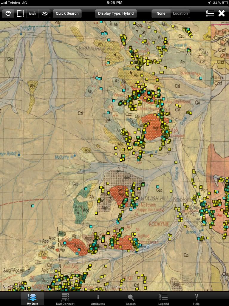
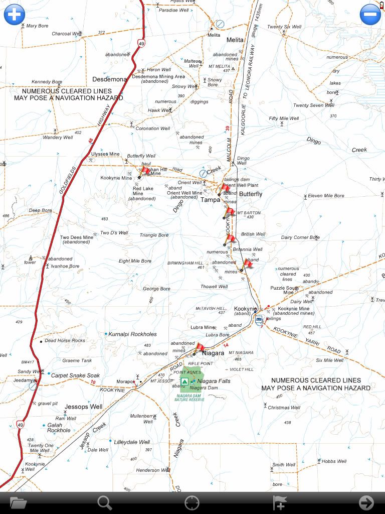
All the map data is available in GIS (Geographic Information System) format. The GIS format is used by most governments and councils to store there information. These files that the information is stored in are called 'shapefiles' . Dots on a screen are no good without a back ground image or map to see where they are, these images/maps are georeferrenced (have cordinates built in) so you dont have to calibrate them and are called 'raster images' Most GIS programs are very implicated and aimed at engineers who like complicated things, and not prospectors like us, and couldn't be taken into the field so no good to us.
Now that the iPhone has GIS apps being made for it we have a solution. The first app I use is GISRoam gisroam.com/ .
Once you have GISRoam on your iPad/iPhone you need some info for it to display, I will use WA as an example but all states have these in some form. The WA info is here geodownloads.dmp.wa.gov.au/datacentre/datacentreDb.asp
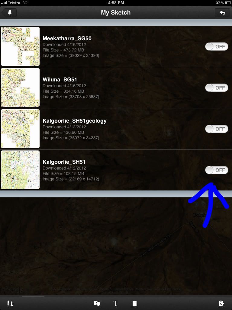
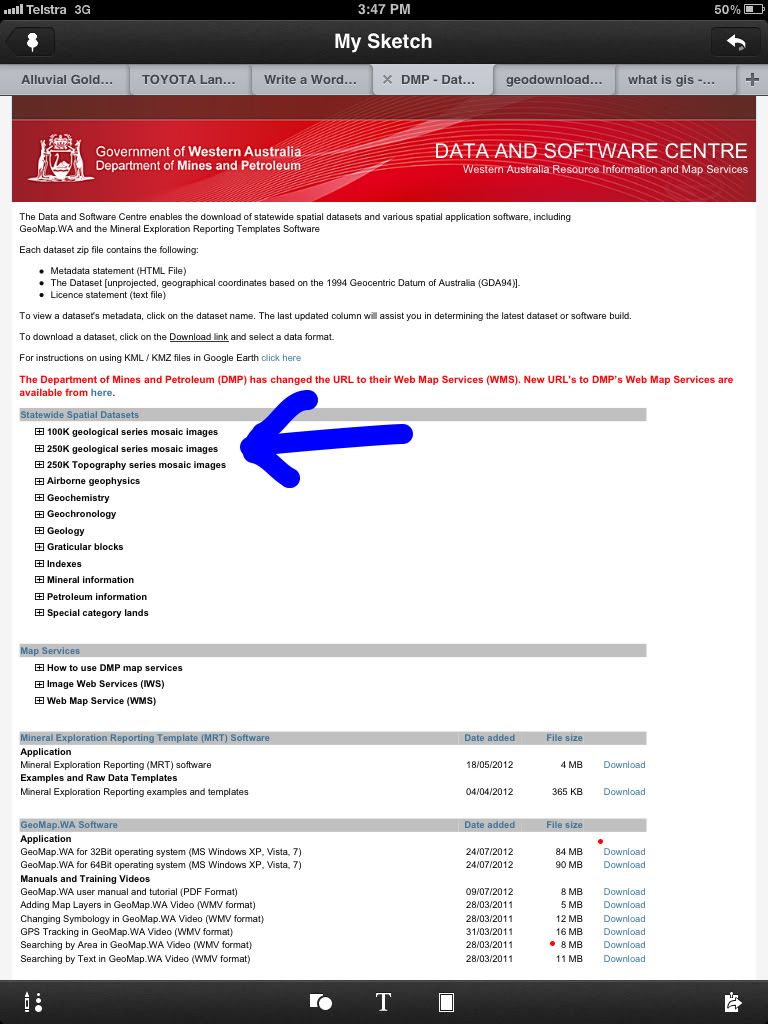
It will look like this, the blue arrow is pointing at where the georeferenced topo and geology images are.
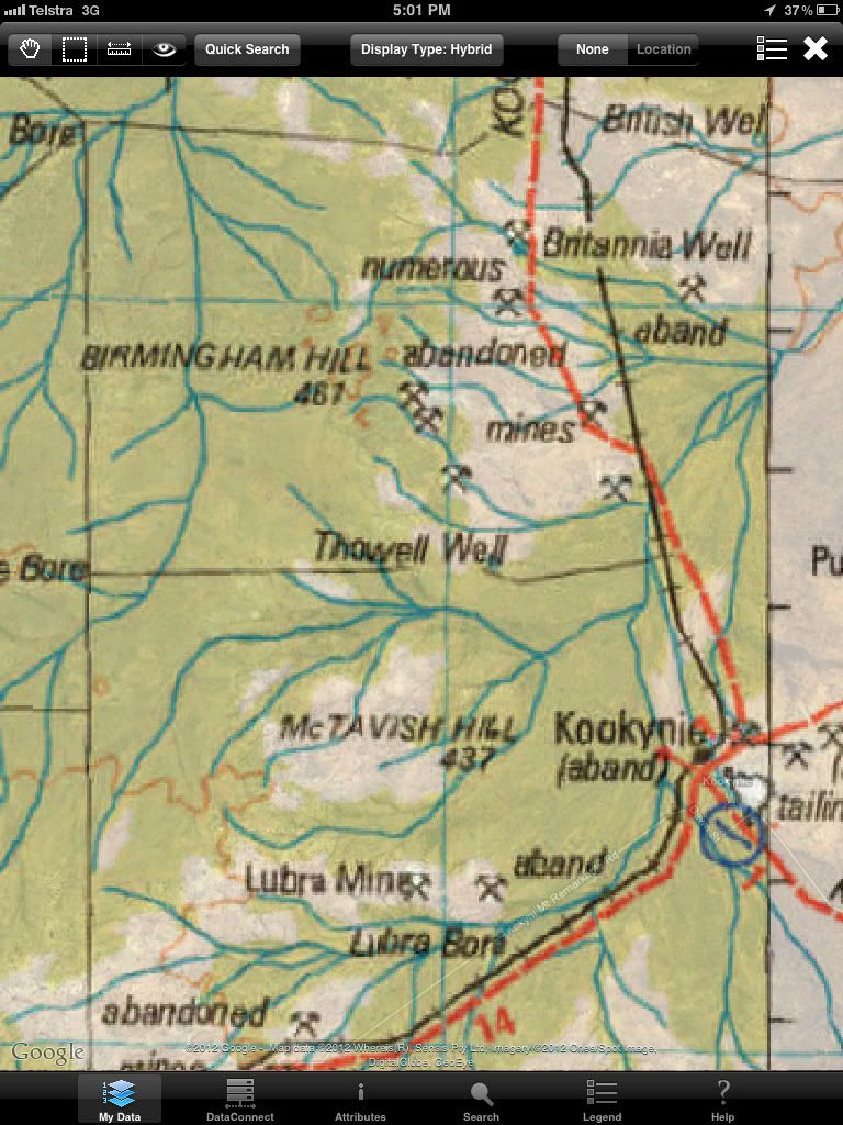
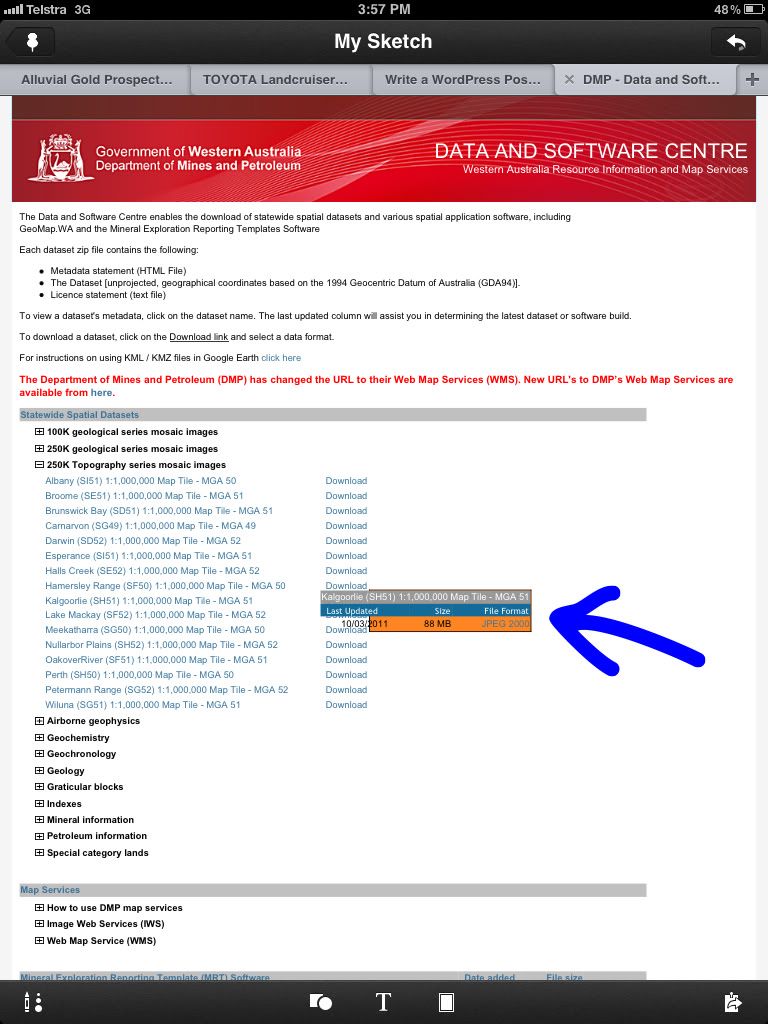
Next click on the type of image you want , I have clicked on 250k topo and then kalgoorlie. The arrow is pointing at jpeg2000 that is a type of raster/georeferenced image, so thatll work. Download the topo and geology images to your computer for your target area (or the whole state like I did).
.
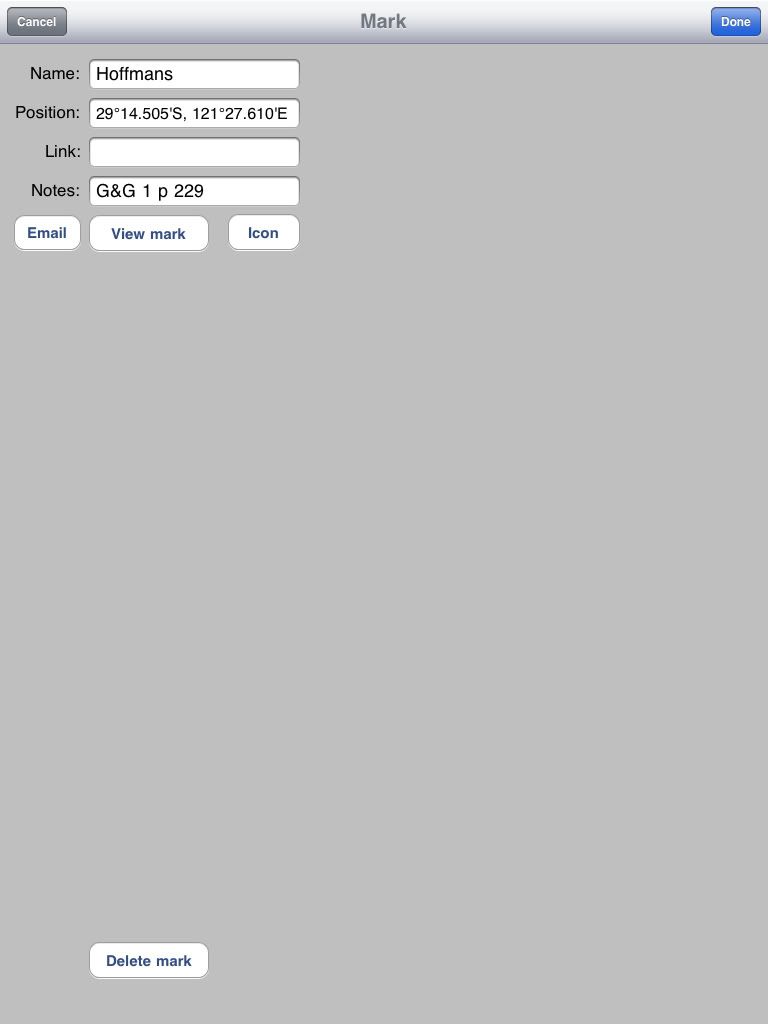
Ok now you have the images/maps you need some shapefiles to display over them
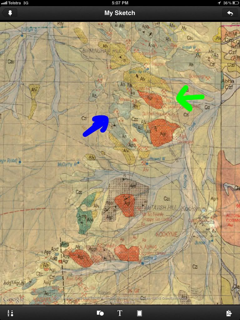
Goto Mineral information then click abandoned mines , it will look like this
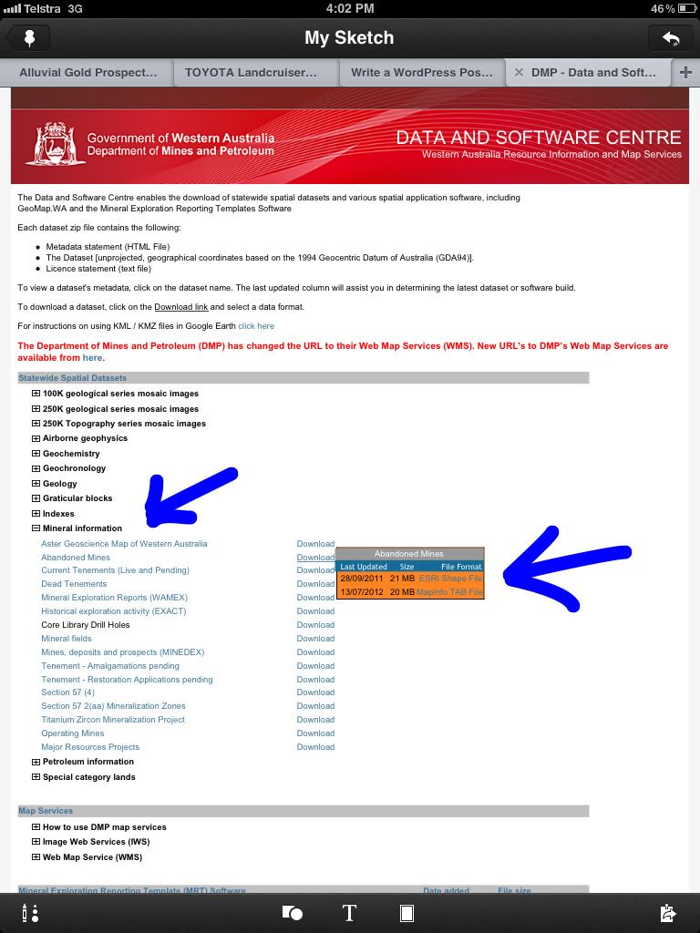
Any esri shapefiles will work so click on that and download which ones you want, I use the abandond mines, current tenements, dead tenements and Minedex.
Once you have these onto your computer, you transfer to GISRoam on your iphone/ipad via iTunes, the GISRoam tutorial covers this.
To be continued..........
All the map data is available in GIS (Geographic Information System) format. The GIS format is used by most governments and councils to store there information. These files that the information is stored in are called 'shapefiles' . Dots on a screen are no good without a back ground image or map to see where they are, these images/maps are georeferrenced (have cordinates built in) so you dont have to calibrate them and are called 'raster images' Most GIS programs are very implicated and aimed at engineers who like complicated things, and not prospectors like us, and couldn't be taken into the field so no good to us.
Now that the iPhone has GIS apps being made for it we have a solution. The first app I use is GISRoam gisroam.com/ .
Once you have GISRoam on your iPad/iPhone you need some info for it to display, I will use WA as an example but all states have these in some form. The WA info is here geodownloads.dmp.wa.gov.au/datacentre/datacentreDb.asp
It will look like this, the blue arrow is pointing at where the georeferenced topo and geology images are.
Next click on the type of image you want , I have clicked on 250k topo and then kalgoorlie. The arrow is pointing at jpeg2000 that is a type of raster/georeferenced image, so thatll work. Download the topo and geology images to your computer for your target area (or the whole state like I did).
.
Ok now you have the images/maps you need some shapefiles to display over them
Goto Mineral information then click abandoned mines , it will look like this
Any esri shapefiles will work so click on that and download which ones you want, I use the abandond mines, current tenements, dead tenements and Minedex.
Once you have these onto your computer, you transfer to GISRoam on your iphone/ipad via iTunes, the GISRoam tutorial covers this.
To be continued..........


 , I have been using basic toppo maps in the vehicle navigation but have not installed anything into the smart phone but will be now.

 .
.