
Post by cronicbadger on Jan 17, 2014 13:59:08 GMT 10
I drove up to Uralla in early January to visit my relatives for a few days. The equipment went with me, sitting quietly in the back of the car, knowing that it'd only see a few hours of digging and disappointment. Had they been even slightly anthropomorphic, an expectant smile would have been apparent on every spade, pan, sieve and bucket.
Woolridge fossicking area is located nine kilometres West of Uralla, on the Rocky River north of Kingston Road, and exists thanks to the foresight of local enthusiast Harry Woolridge, whose excellent rock and gem collection can be seen at the Visitors' Centre. The plentiful gunpowder gold drains into the river from the southern flanks of Mounts Mutton, Jones and Welsh. This continual replenishment system is similar, I think, to that of the famously generous Reedy Creek near Beechworth, Victoria.
I had time for just two trips of several hours duration and so decided to experiment. My plan was to test various areas to get a better idea of gold distribution.
Rocky River was sluiced and dredged, and as a result there are extensive and deep sandy areas interspersed by large fields of boulders ranging in size from beachball to small car.
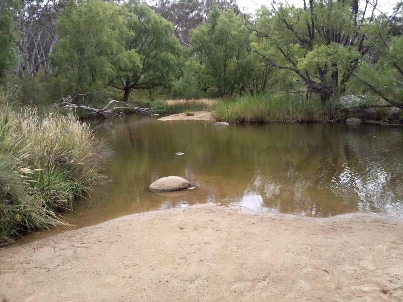
Swimming hole below the main carpark
I walked upriver past the large field of rocks to where it emerges from a sandy stretch of the riverbed.
Although this area is riverbed, flooding over the centuries has left metre-deep drifts of silt on top of obstructions such as logs and boulders - and vegetation has begun to grow here, with multiple water courses winding through the mess. It's confusing to look at, since you find young trees and grass growing on boulders that were probably once isolated in a gravelly riverbed. I don't know how often this process of continual uplifting of the riverbed has been occurring, but it makes it difficult to imagine the original topography of the river.
I suspect (hunch?, wish?) that the riverbed had much less sand before wholesale hydraulic sluicing began in the 1860s. There appears to be evidence of this further upriver in some of the gullies. I'll have to do some research, if only to satisfy my curiosity.
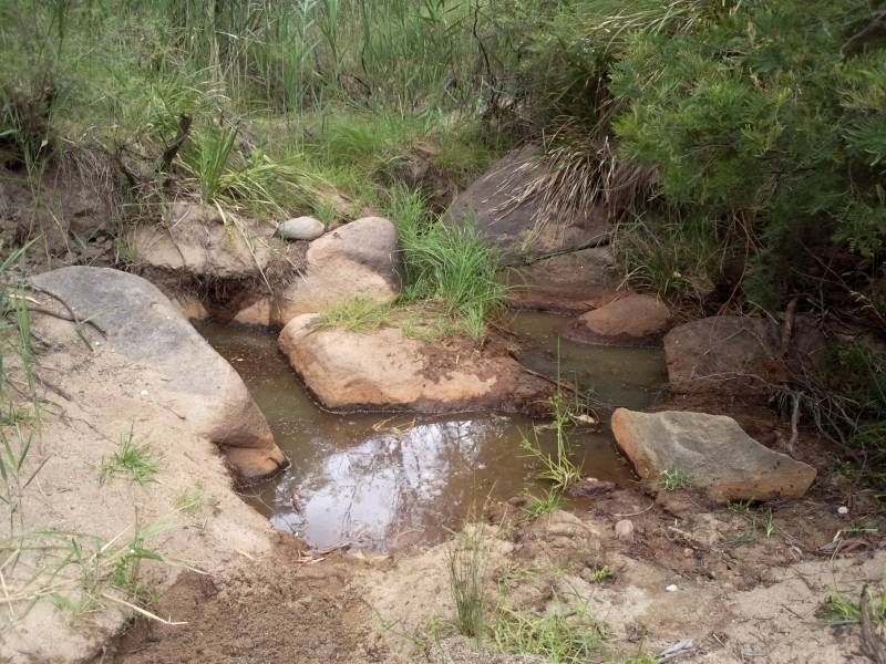
As one can see from the following picture, this small area sees continual interest and features an interesting range of terrain.
A popular spot
Test 1
I marked out a 1 x 2m square area in the sandbank blocking the watercourse then started digging and testing. You can just make out the edge of my filled-in test hole in the bottom left of the photo.
1) The top 20cm is loose sand. Result: No gold.
2) The next 10cm is a layer of humus, possibly from the last flood that was strong enough to wash topsoil this far. However, the black layer of rotten vegetable matter sits just where the water layer begins, so maybe it is simply that it is "floating" in the porous sands. A few flecks of gold were found in this layer.
3) The next 50cm is sand and is where the water sits. No gold was found here.
4) there were small boulders in the next layer. I couldn't see them for the water flooding the hole, and can only wonder if they are sitting on bedrock, and if much of the fine gold has percolated down through the porous, wet sand as far as it can go.
Test 2
There are some holes among the rocks back a bit. Perfect gold traps which obviously see regular activity. There is silt on top of the boulders. There are crevices. There is a sandy stream behind the bunch of rocks.
1) A few specks per pan from the holes.
2) About 10 specks per pan from the silt on top of the boulders!
3) About 30 specs per pan from the crevice.
4) No gold from the sand behind (and hidden by) those rocks.
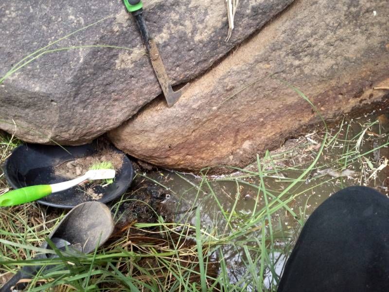
The Crevice
The crevice cuts across the big rock seen at the back of the previous photo. After relocating a panicking spider from the rock I got to work and carefully cleared out much of the crevice using the tools seen in the photo.
Simple, effective crevicing tools
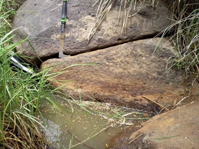
This big rock gave up more gold than everywhere else put together. Thanks, big rock. :-)
I was given a great feeling of satisfaction having tidied up an otherwise dirty, ugly eyesore of a rock. Look at that seam now. A person could eat out of that fissure!
Clean and tidy crevice. Wax on... wax off
So, what did I learn, or what existing knowledge did I reinforce?
Ignore the sand. Perhaps if I dig deep enough in a sandbank there will be a pocket of fine gold at the bottom, and I'll try that next time. However, the basic lesson appears to be to process the dirt, not the sand.
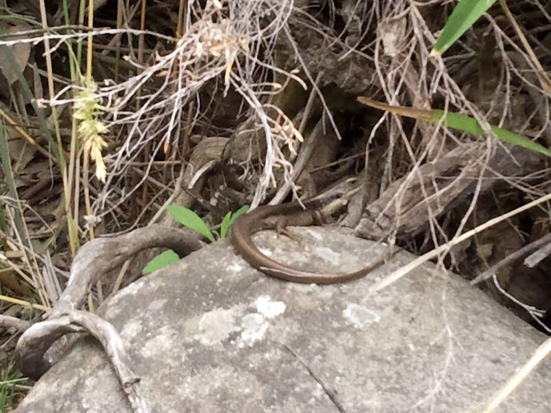
Unfortunately I had no time to visit my nearby "hopefully secret spot" where it never fails to give up good, so I'll leave you with a photo of one of the curious locals, instead.
Curious local guy
Woolridge fossicking area is located nine kilometres West of Uralla, on the Rocky River north of Kingston Road, and exists thanks to the foresight of local enthusiast Harry Woolridge, whose excellent rock and gem collection can be seen at the Visitors' Centre. The plentiful gunpowder gold drains into the river from the southern flanks of Mounts Mutton, Jones and Welsh. This continual replenishment system is similar, I think, to that of the famously generous Reedy Creek near Beechworth, Victoria.
I had time for just two trips of several hours duration and so decided to experiment. My plan was to test various areas to get a better idea of gold distribution.
Rocky River was sluiced and dredged, and as a result there are extensive and deep sandy areas interspersed by large fields of boulders ranging in size from beachball to small car.
Swimming hole below the main carpark
I walked upriver past the large field of rocks to where it emerges from a sandy stretch of the riverbed.
Although this area is riverbed, flooding over the centuries has left metre-deep drifts of silt on top of obstructions such as logs and boulders - and vegetation has begun to grow here, with multiple water courses winding through the mess. It's confusing to look at, since you find young trees and grass growing on boulders that were probably once isolated in a gravelly riverbed. I don't know how often this process of continual uplifting of the riverbed has been occurring, but it makes it difficult to imagine the original topography of the river.
I suspect (hunch?, wish?) that the riverbed had much less sand before wholesale hydraulic sluicing began in the 1860s. There appears to be evidence of this further upriver in some of the gullies. I'll have to do some research, if only to satisfy my curiosity.
As one can see from the following picture, this small area sees continual interest and features an interesting range of terrain.
A popular spot
Test 1
I marked out a 1 x 2m square area in the sandbank blocking the watercourse then started digging and testing. You can just make out the edge of my filled-in test hole in the bottom left of the photo.
1) The top 20cm is loose sand. Result: No gold.
2) The next 10cm is a layer of humus, possibly from the last flood that was strong enough to wash topsoil this far. However, the black layer of rotten vegetable matter sits just where the water layer begins, so maybe it is simply that it is "floating" in the porous sands. A few flecks of gold were found in this layer.
3) The next 50cm is sand and is where the water sits. No gold was found here.
4) there were small boulders in the next layer. I couldn't see them for the water flooding the hole, and can only wonder if they are sitting on bedrock, and if much of the fine gold has percolated down through the porous, wet sand as far as it can go.
Test 2
There are some holes among the rocks back a bit. Perfect gold traps which obviously see regular activity. There is silt on top of the boulders. There are crevices. There is a sandy stream behind the bunch of rocks.
1) A few specks per pan from the holes.
2) About 10 specks per pan from the silt on top of the boulders!
3) About 30 specs per pan from the crevice.
4) No gold from the sand behind (and hidden by) those rocks.
The Crevice
The crevice cuts across the big rock seen at the back of the previous photo. After relocating a panicking spider from the rock I got to work and carefully cleared out much of the crevice using the tools seen in the photo.
Simple, effective crevicing tools
This big rock gave up more gold than everywhere else put together. Thanks, big rock. :-)
I was given a great feeling of satisfaction having tidied up an otherwise dirty, ugly eyesore of a rock. Look at that seam now. A person could eat out of that fissure!
Clean and tidy crevice. Wax on... wax off
So, what did I learn, or what existing knowledge did I reinforce?
Ignore the sand. Perhaps if I dig deep enough in a sandbank there will be a pocket of fine gold at the bottom, and I'll try that next time. However, the basic lesson appears to be to process the dirt, not the sand.
Unfortunately I had no time to visit my nearby "hopefully secret spot" where it never fails to give up good, so I'll leave you with a photo of one of the curious locals, instead.
Curious local guy


